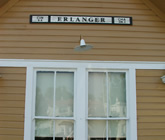
The Railroad
 On May 31, 2024 the Erlanger Land Syndicate recorded in Kenton County Deed Book 47/64 their intention to create the Erlanger Proper Subdivision and divide the property into 220 lots. Thus began the City of Erlanger, Kentucky. The area designated by the Deed Book included: Graves Ave. being 2112 ft. long and 60 ft. wide extending from Lexington Turnpike northward to George Bender's land; Commonwealth Ave. from the Lexington Turnpike northward to George Benders land; Erlanger Road northward to the Longmoore/Graves land. Elm, Queen and Lake Streets were to flow in an eastwardly direction and be short connectors for the major streets initially proposed. Hulbert Avenue, Home Street and Cowie Avenue were established three years later in deed book 66/642.
Timberlake (later to be named Erlanger), like most of the State, was barely touched by the Civil War. With the end of the War, the Northern Communities were looking for a way to enter the Southern Markets. When the Cincinnati Chamber of Commerce began discussions of a Railroad into the area, they were reviving an earlier plan from the 1830's. Louisville was strongly opposed to the route through the central portion of the state as this would pull southern commerce away from their city.
The developers of the Southern Railroad set Chattanooga as the southern terminus. Many cities set proposals as to the location of the rails. Early on the cities of Timberlake and Florence began to set a strategy as to how they could attract the rails into their communities.
Covington and Ludlow both offered generous support to gain the rail route through their city. The heirs of the Ludlow family offered 15 acres for the location of the station in their area. Covington offered $150,000 for the construction of a bridge and depot in their city.